We'll send you email when we release new features and encourage feedback as to what we should tackle next.
Can you share some technical details of your application? (Are you using the commercial control, what version, etc). What technologies does your site use?
We started development in late 2005 using the first version of the Virtual Earth commercial control. Halfway into development Windows Local Live was released and we were blown away by what it had to offer. We knew we had to scrap what we were doing and start over, from scratch.
The back-end is written in C# using ASP.NET 2.0. We've created a sort of plugin infrastructure that allows us to easily add new features as we think of them. There's also a wide variety of generic HTTP handlers. Several are simply proxies to their Windows Local Live equivilant because of the security limitations of the browser's XMLHttpRequest object to make requests across domain boundaries.
On the front-end we created a pretty slick sliding menu system, following the principles of "unobtrusive javascript", that allowed us to place a wide variety of controls, links, and/or information into the application without sacrificing maximum visibility of the map.
We also solved a nagging problem related to IE's lack of alpha transparency support for PNGs. Our first attempt was a combination of DirectX filters and CSS box model hacks to ensure things worked right in different browsers. It wasn't until we started testing using the IE7 beta that we came up with a better solution, this time using another "unobtrusive javascript" approach.
We plan on releasing a few articles at some point outlining some of the challenges and solutions we've come up with throughout this project. We'll most likely offer some of this code as a download from our website.

What is future plan for your Atlas application (new features, etc). and why are you doing it? (e.g. to showcase your skill in VE implementation and to offer your services?).
For our next feature we're looking hard at Flickr integration. GeoURL.org has some interesting possibilites. Maybe weather data. We literally have hundreds of ideas in the pipeline. We'd love to hear more from the community!
Part of it is to see just how far we can take the "hackability" of the Virtual Earth web controls. The ultimate for us would be to create a tool you use every day. We want to be the guys that when people think about something geospatial they are thinking, "there's gotta be something like this at freshlogicstudios.com".
What is your background and what is your experience with Microsoft mapping technologies?
We started hacking around with Google Maps after it was released in February 2005. We had a lot of fun coming up with this and that, but ultimately we became very dissatisfied by its lack of developer friendliness.
We were more satisfied after we began working with Virtual Earth and almost had a working version of Atlas done in late 2005. Then, Windows Live Local launched and we decided to hold off releasing Atlas until we could rebuild it from scratch using that new technology.
If you could change one thing in the Virtual Earth map control, what would it be?
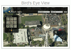
The Bird's Eye user interface.
We love the imagery provided by the Bird's Eye feature. However, we don't really agree with the user interface model Microsoft put together. The road, aerial, and hybrid image sources allow for a fluid pan that can seamlisly take you from Los Angeles to New York where the fluid AJAX tiling simply loads each tile as they come into view. Bird's Eye breaks this model and instead presents the user with a 3x3 thumbnail grid for navigation. The panning is severly limited and it's not consistent with the rest of the interface.
Our opinion is that there's not room for both models. The perfect scenario would be for the Bird's Eye imagery to behave exactly like the road/aerial/hybrid imagery. We have a feeling that could be quite an implementation challenge but would make Bird's Eye extremely more useful.
In Windows Local Live the Bird's Eye view has a nifty ability that allows you to change the direction of your view. Instead of north always pointing "up" you can rotate the map. We haven't included this feature into Atlas yet. We think it would be ideal if this feature was added for consistency with the road/aerial/hybrid imagery.
Discuss this story in the forum.
Author: 


 What is the purpose of your Atlas application?